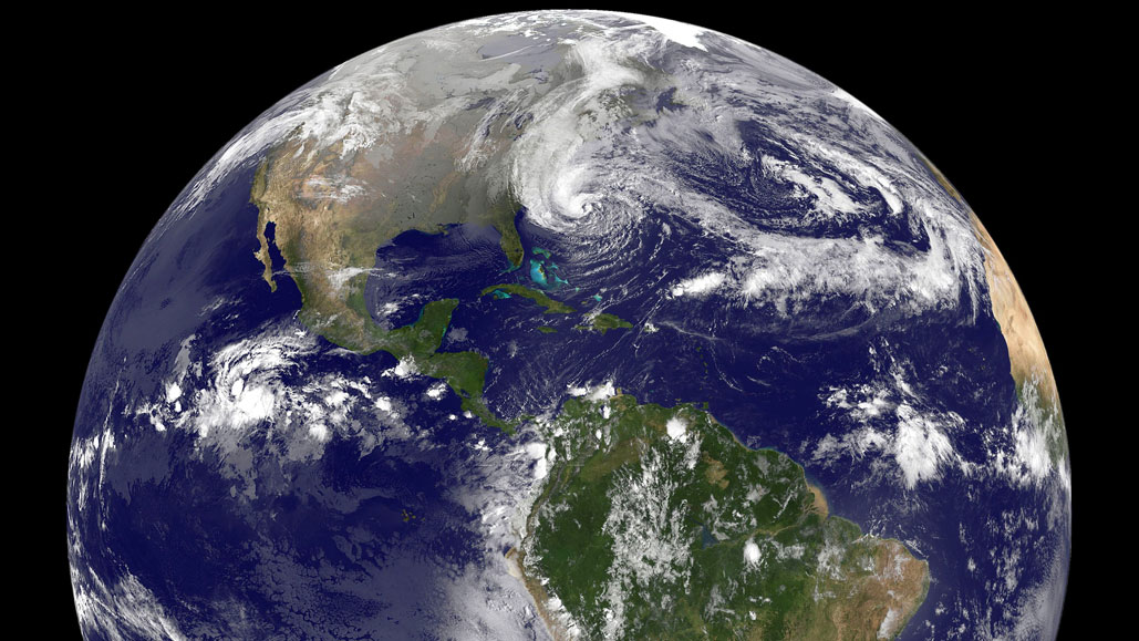
Frankenstorm Sandy
Last year at this time we got smacked with a snow storm that brought many New England communities to a standstill. This October, instead of snow, we will wrap up the month with a hurricane. Not just any hurricane, but a “Frankenstorm.” This giant storm has already wreaked havoc in Cuba and the Bahamas. As it heads north, coastal flooding, flooding rainfall, high winds, downed trees, power outages, and snowfall are all possible. Weather-geeks on the East Coast are all a-twitter over this one!

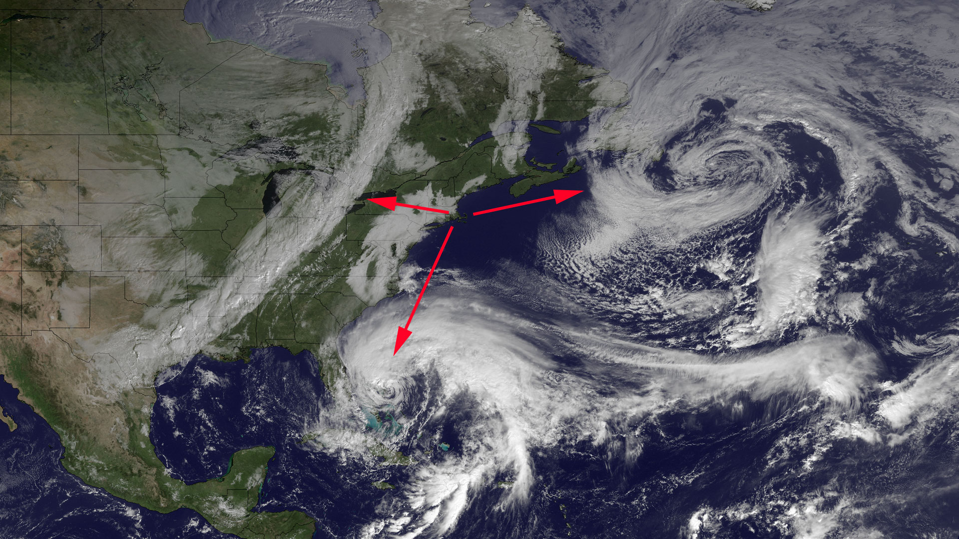
Why is this storm such a monster? Hurricane Sandy was coined a “Frankenstorm” because of a rare confluence of factors: an existing storm to the east of it is causing Sandy to take the unusual path of turning westward into the coast instead of moving out to sea; the existing storm is making Sandy’s movement slower than usual; Sandy is coinciding with very high tides; there is a cold front coming down on Sandy’s northwest. So even if the force of Sandy’s wind is only at the CAT 1 level, the duration will be much longer than many past storms. Trees which normally survive occasional sub-100 mph gusts may not fare as well with the sustained nature of Sandy’s expected winds. As a consequence, greater property damage and more power outages may be the result.

A major factor contributing to the Frankenstorm’s expected damage is the timing of when it will hit land. The storm will smack into New England during a full moon. The gravitational pull of the moon normally raises the level of the tide, and with the additional wind from the storm, tides could overwhelm many of the protective barriers currently in place. Coastal cities and communities are at extreme risk of severe flooding as the result. NYC and Boston have already closed their public transportation system.

The final piece of this Frankenstorm is that the moist, wet air being brought in from the ocean by Sandy is going to meet the cold air coming down from the north. When the 900-mile wide storm runs into that wall of cold air, places such as western Maryland, Virginia, and central and western Pennsylvania may see wet, heavy, powerline-dowing snow fall.

We have been preparing since Saturday. The interns have moved everything indoors, went food shopping, gassed up the cars, and made a nice stew. We will now stay inside to wait out the storm. Hopefully, Sandy’s timing will not coincide with the worst-case parameters and we will all skirt by without incident. Hey, at least it is not snowing 🙂


Leave a comment